Showing posts with label Sundays. Show all posts

Friday, November 25, 2011

NOAA Station

Following a wonderful umu meal at our friend Visa's house and a short side trip to feed our "take away" breadfruit to some stream fish, Sara and I decided to explore the NOAA observatory and weather station out on the Eastern tip of the island. A few of our friends had visited the facility a few weeks before and reported back that it was worth the trip. It had been a few months since we'd been out to the east end of the island, so we thought it would be worth the trip. The drive out there is full of interesting sights and well worth it.

This is only the second time I've been out to the Eastern tip of the island. It's a beautiful drive out there and I love how once you get past the canneries in the harbor, the island quickly transitions to small quiet villages that are dotted along the lonely single lane road.

The NOAA weather station that sits out on the Eastern Tip of the island is one of the few permanent presences of the federal government here in American Samoa. It has the unique distinction of being the spot with the cleanest air in the world. Or at least the place that NOAA uses air samples from to determine what the "clean-air" baseline is. I find this a little odd, since the people of American Samoa burn their trash and waste on a daily basis and a healthy majority of the vehicles on island do not have any pollution controls, but I guess when the wind is blowing in the from east, the air there has come from a thousand miles of open ocean to reach there.

The turn off to the Observatory is unmarked, but it's pretty obvious which of the dirt tracks runs to the top of the hill at Cape Matalua, the NE tip of Tutuila. We followed the road up past a few homes and came to the gate of the NOAA facility. The plateau of the mountain was filled with the observatory proper and a number of instruments scattered around the grassy area. Sara and I spent some time trying to determine what each's purpose was.

Once we had explored all the sciency things at the Observatory we came across one last highlight, the stairway down to the cape. It is a long wooden staircase, containing over 200 stairs at a 45 degree slope down the mountainside. The thoughtful designers even placed several benches in to make sure there'd be places to rest.


The climb down wasn't bad, but knowing we'd have to go back up was a tickling in the back of our heads as we headed down.

The Cape at the base was beautiful. It's a peninsula that was bare rocks covered in moss and grass with the crashing Pacific on all sides.

We hung out for a bit and just appreciated the remoteness and ruggedness of our little island. Well worth the trip out.

All that was left was our hike back up. Thankfully we've been doing enough hiking that it wasn't too much of a challenge.

Thankfully, all that was left to cap off this Sunday was a stop at Tisa's on the way back to our side of the island.

Monday, September 19, 2011

Mt. Alava Through Hike


Previously, we climbed Mt. Alava along the ridge trail that starts on the east side of the ridge. Wanting to try to improve on the 7-mile out-and-back-hike, we decided to start the hike on the northeast side of the mountains and turn it into a through hike.

To do this we started at the trailhead that I had previously gone hiking along a loop through the National Park and for the Vatia Tide Pools. It"s a small turnout off the round inside the National Park with a little fale and enough room to park a few cars. From here we ran into a group of palagi who were headed down to the tide pools. We instead started taking the path up the hill.

The trail up the ridge is well maintained and makes for some easy hiking compare to most of what we have here in American Samoa. The National Park Service is good at maintenance and the trails see a relatively high amount of usage, so there's less overgrowth and underbrush to worry about on this trail.

Another nice feature of this trail is the first bit is through heavily canopied forest, but the trail rises fast and you quickly get up to the ridgeline and get to see some spectacular views looking out on the north-side of the island. The ridge is great for hiking you get breezes from all directions and it's some of only cool air you can get outside on this tropical island.

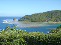
This shot is of Vatia Bay and the rock formation known as the cockscomb. The trail keeps climbing and soon you end up on the ridge that runs down the spine of the island, Pago Harbor and the south side of the island on your left and the National Park and the north-side of the island on your right.

At this point, the chest cold that had been bothering the prosecutor, who'd joined Sara and I for our coast walk, began to take its toll. She and her boy friend opted to down hike instead of finishing out the through hike. We were sorry to see them call it quits, but we did get to continue with her french cousin who was visiting the island. He turned out to be a hoot and we ended up making plans to hang out while he's on the island visiting and beyond.

The trail also throws starts to get steep along the ridgeline. Since it needs to follow the contours of the ridge, the hiking trail needs to follow the ridge line. The Park Service has installed cable and faux-wood ladders to made these sections passable. This leads to some interesting assents and descents as you need to clamber up and down the trail using both your hands and your feet.

The sketchiest section is right before the summit. The trail narrows to less than a yard wide.
Both side fall away vertically. It's a smooth dirt path, but there are enough lava rocks jutting out of the ground to make it interesting. This is a section of trail that is not for the weak of knees. Someone in our group, I'm not going to name names, almost had to crawl. I lent out my trekking poles and they were able to navigate it under their own power. But it was a slow 30 yards of hiking.

The top has some spectacular views of the harbor. The old cable car system, they had in place to service the navy radio towers, fell down in a cyclone years ago. But the landing at the summit makes for a great viewing of the harbor and Matafao, the highest summit on the island.

The down hike from the summit along the service road was less exciting. We'd done this trail before, it's smooth hiking except when it gets wet, then the road either gets really muddy or the steep sections get slick. Our down hike was pretty easy. Just some good conversation with the visiting Frenchman.

The last little bit of work was to get the cars we left at the trailhead. It took a bit of driving, but we were rewarded on our way home when one of the people we saw going to the tide pools at the beginning of the hike called us up and invited us to make burritos using some fresh fish that one of the National Park Rangers caught on his charter boat back from the Manu'a Island Group. Nice reward for on the loner hikes you can do on island.

Tuesday, September 13, 2011

LBJ Waterfalls to Fagatago Hike


Sundays are always limited in what we can get out and do. Since Samoans close most beaches and activities close to villages, us heathens are forced to find the few activities that are still open to us or go to the same bar that we always do. This weekend we opted to try a new hike. It shows up as two trails that appear to link together on the map of Tutuila I inherited from an Aussie wildlife biologist who left island a few months ago. The one hitch is that when paths sit unused for more than a few weeks here, they grow over and unless you know precisely where to go, you're hacking your way through the bush with a machete and guessing where you're going to end up.

The first trail begins in the quarry that is located up the valley that's behind the Lyndon B. Johnson Tropical Medical Center, the only hospital in American Samoa. The path follows the creek up some steep dropoffs. Each drop off had its own waterfall and pool. We saw some great freshwater aquatic life on the hike up, including a huge freshwater eel, some monster shrimp and a few other fish that were too shy to identify. The climb up a few of the slopes alongside the waterfalls were closer to rock climbs than hikes, but it was wonderful to do some hiking that felt closer to the lush creek valleys of Northern California or the Pacific Northwest than the tropical South Pacific. The path was hemmed in by steep slopes on both side for most of the way up. At the 6th waterfall we were unable to climb further and thus had to do a little exploring to find where to link up with our next trail. We hadn't seen a trail link in to the trail we had been following so we were forced to do some creative exploration. We followed a creek that connected in, but the rock scramble was difficult and eventually everyone turned back to the original path but me. I eventually dragged myself up to a muddy cliff that would not be easily climbable and had to descend down to the first creek in defeat.

We then opted to take a brief break at a man-made damn that had been constructed on the upper reaches of the LBJ creek. After our rest Sara picked out a ridge line that was headed in the direction we needed to go to connect with the next trail and started climbing. The ridgeline was an easy climb out of the drainage that we had been hiking in. The forest in this area was thick enough in the canopy that little under brush grew on the slopes and it was easy to hike our way to the ridge.

On the climb up we found a few stone age homestead sites. These are identifiable as the are terraces that are built into the hillside. All of the historic structures have long since been reclaimed by the jungle, but the foundations of these old houses are still cut into the hillside.

Once we made it to the top of the ridge we were able to find some flags that marked the Department of Marine and Wildlife Resources bird survey transects. These were along the path that we were trying to link up with, so good work on our orienteering.

All we had to do was follow the path down to Fagatago and we'd comlpete our planned route. After 20 minutes of hiking we lost our DMWR flag line. Knowing that we were close to our destination, since we could hear the activity from the port and harbor we opted to take the direct route, straight down the ridge. This turned out to be a huge mistake. Our route was steep, treacherous and not a trail. The hiking soon became scrambling down the sketchy slope on our butts. It then got even steeper, to the point that we were climbing down using tree roots and trunks to keep a hold to the slope. The pictures do no convey the loose dirt and rock that would constantly slide out from underneath us and send head sized rocks rolling off the side of the hill. Not wanting to try and take this route back up to the trail, we soldiered on and kept pushing for the road or path that we felt must be below us. Eventually our persistence paid off and we found a creek, similar to the one we started at hours ago near LBJ.

Following its course we soon came to an abandoned house foundation and were able to follow the crumbling path back down to the village of Fagatago. Dirty, sweat and still alive we opted to reward ourselves with drinks and a meal at Tisa's Barefoot Bar, since, after all, that's what we end up doing every Sunday here in American Samoa.

Tuesday, August 16, 2011

Blunt's Point and a Sunset


There are still a few remnants of American Samoa's navy legacy. The territory was originally brought into the United States as a navy fueling station and then it turned into a full navy base after the start of World War II. Some of the navy infrastructure is still in use today. For example, the High Court is the former Navy Administration Building and the initial road around the island was Navy-built.

Some portions of the Navy infrastructure, such as the pillboxes that line many of the beaches, are sitting lonely and forgotten. The guns that used to guard Pago Harbor are also not seeing any use these days. On a lazy Sunday, we made it a point to hike up the trail that leads past a number of these gun placements lining the West Side of Pago Harbor, on what's known as Blunt's Point.

The walk up the ridge afforded some great views of the harbor
and Fatu Ma Futi. Driving and paddling by these sights on a regular basis has caused me to start to take them for granted. It was nice to get a different perspective from up high and appreciate them from another point of view.

These guns were supposedly pulled off a period battleship and mounted to guard the approach into Pago Harbor. They sit on the ridge rising from Blunt's Point. It's just a short hike up a trail starting next to the "I.B.M" laundromat. (Side note: most of the shops here are known by people's names or initials, which leads to some interesting and random titles.) Following a double-track trail that leads through some breadfruit groves, the hike wrap around the hillside, past a water tank, and around to the first gun placement. The massive gun has gone through a number of rust and repaint cycles, but is still gazing out over the opening of the harbor. The ammunition depot below it is also still there, but the lower level has started to fill with water, so we didn't do much exploring, although the bat biologist in the group went looking for some possible nests.

The trail continued up the hillside and the concrete path that used to lead to the second gun has deteriorated and eroded. The rusted-out stumps of the handrail and a few off-camber portions of the concrete walkway remain to lead the way to the next gun placement. This one was in worse shape: the foundation and
ammunition cellar had plugged up and filled with water. These issues have been going on long enough to develop a fish population in the water. With the way any metals rust under the relentless moisture, salt-spray and temperature here, I can't imagine this gun will last too much longer in its present state.

Further up the hill there was evidence of more development, but the rain forest had reclaimed whatever had been there. In fact, among the odd depressions and remaining cement, Sara and I happened upon one of the largest hermit crabs we had ever seen, who looked extra fierce with his heavily armored brown pincers.

After exploring the Blunt's Point trail, there wasn't enough day left for snorkeling. Instead, after a brief cocktail break at the Goat Island restauraunt, we opted to head out to Vaitogi and watch the sunset from a bluff near Sliding Rock.
We got there with time to spare and grabbed some grass next to a few graves situated alongside the road. We then spent the last part of the day watching some surfers rides the waves, a few of the early-arriving southern humpback whales spout and the sun drift below the horizon. Not a bad way to spend your down day on the island.

Monday, August 8, 2011

Vatia Tide Pools and Tisa's

Sundays are a dead day in Samoan society. Few stores are open and most people spend their day in church or sharing a massive umu meal with their family. I really don't have much of an issue with this, only that the Samoans use it as a excuse to close down their beaches and not allow any swimming or activities near villages. Thus, non-church-goers and non-binge-eaters like Sara and I end up trying to to plan activities at some of the few spots that remain open on Sundays. Luckily for us, there's a large portion of the palagi community that's in the same boat, so when one of our friends suggested the Vaitia Tide Pools, Sara and I jumped at the opportunity to get out and go to one of the few swimming areas that's not close to a village.

We and some friends from paddling rallied up in the late morning at the house of another married lawyer couple and headed out. Sara and I got to see the island in style - we rode in the back of our friends' pickup truck in beach chairs, which is the true Samoan way to get around the island.
There's really no better way to see and feel the mass of the rainforest-covered volcanic peaks than from a truck bed. Though my hat kept trying to fly off, it was a blast. It makes me want to have a pickup truck just for transporting our eventual visitors.

I'd been down to the tide pools previously, after a long hike in the National Park. It's a beautiful spot that looks out on the Cocks Comb rock formation on Vaitia Bay. This time I also had the benefit of bringing a camera (and my lovely wife).


The hike down to the tide pools from the National Park fale isn't long. It's a little steep and rocky, but there are a few interesting archaeological sites along the route. The Park Service has some good signs explaining their finds from a dig five years ago, and if you take some side trails you can see a few artifacts that have been allowed to remain in place.

The trail down also offers some some great views of Pola Islannd (the Cock's Comb). Every few weeks I need to remind myself that I live in one of the most beautiful and dramatic island landscapes around. Too often I get mired in the suburbs-lite feel of the Tafuna Plain. I need weekend trips like this to balance out the trash and traffic of the south side of the island.

The wind was blowing pretty hard once we reached the rocks above the tide pools. This was driving some large swells. Even at low tide, the pools were getting refreshed on a pretty regular basis. We set up camp on the rocks and a few people walked down to the pools and snorkeled around the largest pool. I worked up a little courage and did a dramatic entrance by taking the plunge into the water from the overlooking rocks. I also coached one of the other attorneys from my office into making the jump. It's a little spooky since the landing area is narrow and the footing up top can be a little slick when it is wet.

Another member of our party lost his wedding ring in the pool. A frantic snorkel search was commenced, but the wave action that was feeding the pools turned out to be a little too much and the ring became a permanent resident.

Sara, still a little gun shy after her last tide pools experience, opted out of the swimming. Turns out, she might have been on to something. Soon after the low tide, the waves picked up. They were regularly crashing over the rocks and aerating the tide pool. These occasional surges were dramatic and shoved those of us swimming in the pools around, but didn't cause too many problems. The real danger was that the waves were crashing over the only exit point for the tide pools. As a result, each person needed to use some spotters from the high ground, since they couldn't see the waves coming when they were in position to climb out. I made it up without issue, but a few of our group did get caught in some waves upon exiting the pools. Not being able to offer assistance against the crashing walls of water or the slippery, sharp rocks, I did the next best thing, I captured it on video.


After the pounding, cut short our trip to the tide pools, we decided we needed another activity to fill the remainder of the afternoon. With few places being open, we opted for the palagi standby of Tisa's Barefoot Bar. Something about Vailimas, banana fries and Pina Coladas on the beach do an amazing job of patching up bruises to the body. Just another weekend in paradise.

Sunday, June 26, 2011

East Side Sunday


We decided on Saturday evening, after having a chore laden day to
head out to Aunu'u on Sunday. Aunu'u is the island that is about a mile south of the eastern end of Tutuila. It's supposed to have a cool small village, a lagoon in an old volcano crater, some caves and a number of worthwhile sites. With our group, consisting of a driver who's on a short contract with the Park service, a criminal prosecutor from our office and us, we got an early start off to the east side of the island to see what trouble we could get into.


One of the first sites on the way out to Aunu'u, besides the green volcanic islands we saw here, is an old shipwreck that's washed up on the shore right beneath the coast road, past Pago Harbor. The old hulk's rusted through to the point you can see the waves washing through the seaward side. There were even a few boulders which had landed on the deck of the old ship. We couldn't fathom how they ended up there, with the steep cliffs being at least 50 yards back from where the ship came to rest. It must have been quite a slide or one heck of a bounce to make it up that high and that far out.

Here's the view looking out towards Aunu'u. It's the smallest inhabited island in the territory. There's a tiny village on the island which receives most supplies and basic commodities by regular boat trips which depart from a small wharf/harbor near the eastern end of Tutuila. The beaches along the North end of the island are supposed to be nice and there's a hiking loop that we've heard good things about. Plus, there are no cars on the island, just foot traffic, like the islands have been for centuries prior. Sort of a throw back, to how Tutuila was prior to the federal government taking a real interest in the welfare of the locals. Some of the stories I've heard from the locals tell of getting around by horseback and a true tropical paradise, not the cross between consumer culture and the native culture we now see on the island.

Once we made it to the harbor, there weren't any boats waiting at the dock. So we lounged for a bit on the breakwater that protected the harbor and tossed the rugby ball around. The weather was sunny with enough of a breeze to keep the heat from getting to be too much. I received a little bit of a scare when I realized I couldn't find my keys. Convinced they fell down between the rocks of the breakwater, I was sure we'd never be able to find them. Sara also didn't bring her keys. (Way to fall down on the job, Sara - you're supposed to be my backup in situations like these.)

After waiting a while, a boat arrived and started loading up with
some supplies. After we talked with the Aunu'u-ese they said the island was closed to outsiders on Sundays and we wouldn't be able to make the trip out there. They told us "No tourists on Sundays, come back tomorrow." Too bad we all had work tomorrow (Monday). A little bummed, we rallied up and decided to follow the coast road out to its end. We hopped in the NPS vehicle and continued our trek out East.

Near the end of the road, it wraps around around to the north side of the island. Not far from where the road ends, you get some great views looking along the north coast of the island. In the distance of this picture you can see the Cock's Comb, or Pola Island if you prefer the Samoan name. The North Coast of the island is steep and dramatic. We'll need to work on getting out here more and spending some time in the more remote sections of the island. The road ends a short way down from here. It ends with a whimper. - The pavement stops, three driveways head off in different directions, and that's the limit of how far you can go on the East end of the island.

We did a little exploring, I almost made it up to the top of a palm tree, problem was, once I got up there I couldn't use my hands to free a coconut, they were too busy holding on for dear life to the trunk of the tree. I need to work on those thigh muscles before I'll be an able coconut gatherer.


The Eastern point of Tutuila is sort of the end of the world for us. It's odd to feel physically bound to this small island. Sara and I don't have island fever yet, but I see it in people who have been here longer than us. We'll see what happens when we start to feel the small size of the community and island.

We also have seen this phenomena around the island at various spots. Rumor has it, its a means to keep ghosts and spirits away. Who knew that old detergent and bleach bottles could be that useful. The smaller villages are full of little superstitions like this, we need to get out and get a little more details to confirm or deny the ghost stories.

With our plans to visit Aunu'u in tatters, we opted to go to our new favorite east-side Sunday activity: Tisa's Barefoot Bar. We rolled up and the beach scene was in full effect there. We were able to grab a table on the deck overlooking the beach. A few Vailima, some snorkeling and socializing with the island's palagi population soon had us in good spirits.


There was even a tattoo artist working with the traditional Samoan tattooing fork. It looked like a time consuming and painful process, even more so than usual, since the guy receiving the tattoo was almost a tourist attraction under the fale next to the bar. We at least asked if we could take his picture first, but I wouldn't want to be in his place. It may not have been the Sunday we planned, but it turned out quite excellent and we'll always be able to make it Aunu'u another weekend...

Once we made it home, Sara and I had to devise a way to break into the house. Our back door hadn't locked properly, so we were able to make it back in without too much shattering of glass or otherwise. Turns out someone (Sara), had borrowed my keys to grab a few last minute additional items and left my keys on her dresser upstairs. Thanks for the scare, Sara. Er, I mean it's good we got back into our house without too much trouble.