Monday, September 19, 2011

Mt. Alava Through Hike


Previously, we climbed Mt. Alava along the ridge trail that starts on the east side of the ridge. Wanting to try to improve on the 7-mile out-and-back-hike, we decided to start the hike on the northeast side of the mountains and turn it into a through hike.

To do this we started at the trailhead that I had previously gone hiking along a loop through the National Park and for the Vatia Tide Pools. It"s a small turnout off the round inside the National Park with a little fale and enough room to park a few cars. From here we ran into a group of palagi who were headed down to the tide pools. We instead started taking the path up the hill.

The trail up the ridge is well maintained and makes for some easy hiking compare to most of what we have here in American Samoa. The National Park Service is good at maintenance and the trails see a relatively high amount of usage, so there's less overgrowth and underbrush to worry about on this trail.

Another nice feature of this trail is the first bit is through heavily canopied forest, but the trail rises fast and you quickly get up to the ridgeline and get to see some spectacular views looking out on the north-side of the island. The ridge is great for hiking you get breezes from all directions and it's some of only cool air you can get outside on this tropical island.

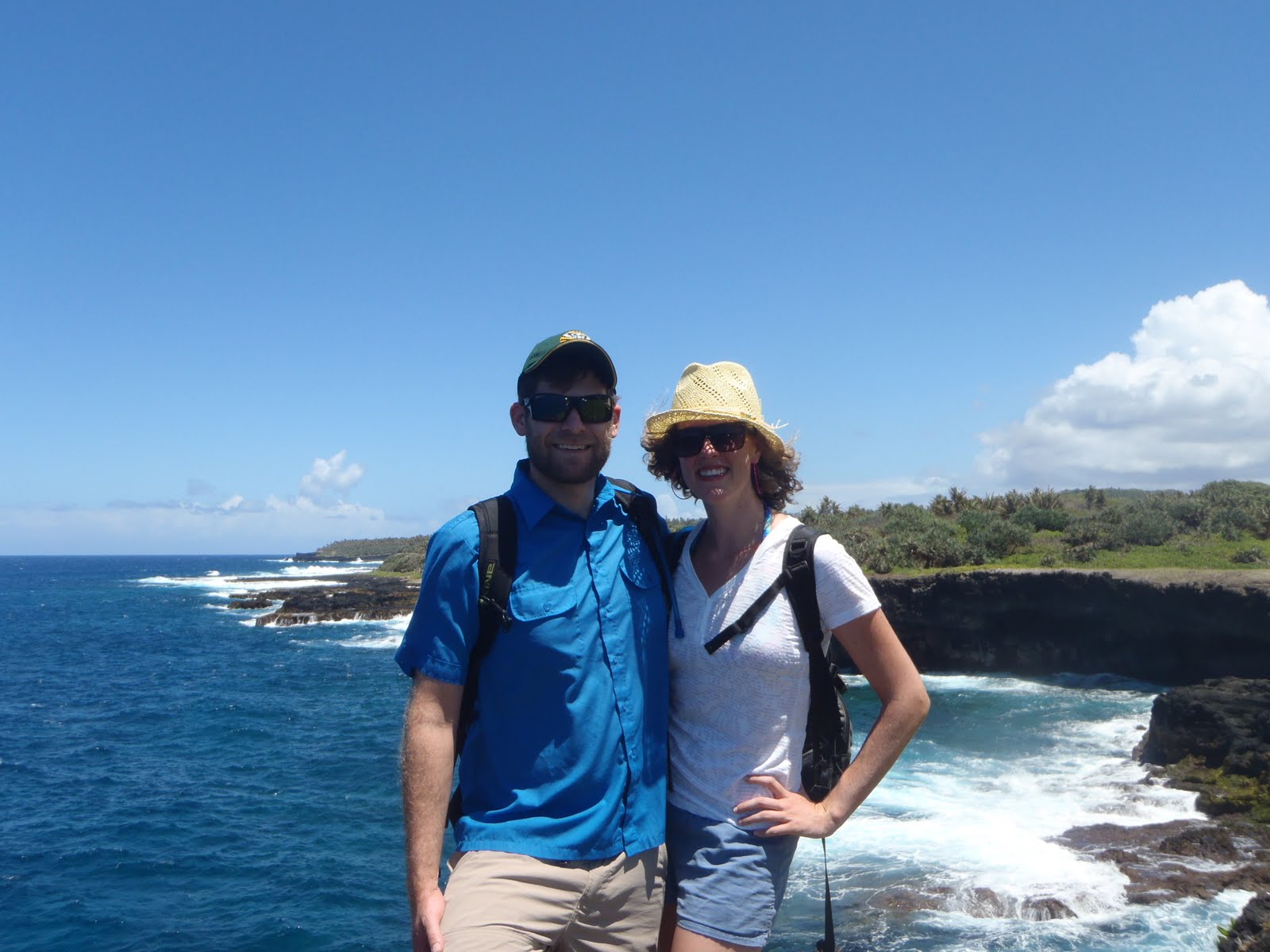
This shot is of Vatia Bay and the rock formation known as the cockscomb. The trail keeps climbing and soon you end up on the ridge that runs down the spine of the island, Pago Harbor and the south side of the island on your left and the National Park and the north-side of the island on your right.

At this point, the chest cold that had been bothering the prosecutor, who'd joined Sara and I for our coast walk, began to take its toll. She and her boy friend opted to down hike instead of finishing out the through hike. We were sorry to see them call it quits, but we did get to continue with her french cousin who was visiting the island. He turned out to be a hoot and we ended up making plans to hang out while he's on the island visiting and beyond.

The trail also throws starts to get steep along the ridgeline. Since it needs to follow the contours of the ridge, the hiking trail needs to follow the ridge line. The Park Service has installed cable and faux-wood ladders to made these sections passable. This leads to some interesting assents and descents as you need to clamber up and down the trail using both your hands and your feet.

The sketchiest section is right before the summit. The trail narrows to less than a yard wide.
Both side fall away vertically. It's a smooth dirt path, but there are enough lava rocks jutting out of the ground to make it interesting. This is a section of trail that is not for the weak of knees. Someone in our group, I'm not going to name names, almost had to crawl. I lent out my trekking poles and they were able to navigate it under their own power. But it was a slow 30 yards of hiking.

The top has some spectacular views of the harbor. The old cable car system, they had in place to service the navy radio towers, fell down in a cyclone years ago. But the landing at the summit makes for a great viewing of the harbor and Matafao, the highest summit on the island.

The down hike from the summit along the service road was less exciting. We'd done this trail before, it's smooth hiking except when it gets wet, then the road either gets really muddy or the steep sections get slick. Our down hike was pretty easy. Just some good conversation with the visiting Frenchman.

The last little bit of work was to get the cars we left at the trailhead. It took a bit of driving, but we were rewarded on our way home when one of the people we saw going to the tide pools at the beginning of the hike called us up and invited us to make burritos using some fresh fish that one of the National Park Rangers caught on his charter boat back from the Manu'a Island Group. Nice reward for on the loner hikes you can do on island.

Coast Walk

Sara and I wanted to follow up on our previous weekend's expedition to along the coast west from our house. We did the previous hike with some friends who brought their five-year-old daughter. While sharing the waves and the seashell hunts with a kid that young is fun, it also slows you down quite a bit. Thus we opted to try the hike again, but this time as just with us and one of the criminal prosecutors from our office.

The hike picks up about a half a mile up the road from our house. A small dirt road turns off our road near the end of the airport runway and winds back around towards the coast. We parked at the house of one of the employees of the EPA (who we chatted with as he was heading out to another palagi's going away party) and started our hike.

The coast in this section is all tall cliffs of volcanic rock. The dramatic part is the way the waves roll in with full force and break against the base of these rocky cliffs. Along the route we were treated to blow holes that channeled the waves force up through old lava tubes or passages through the rocky cliffs. This can lead to large holes that boil over with white water on large waves or smaller holes that blow tufts of mist up into the air. Or my personal favorite which is a large void at the water line that fires a forceful gust of air through a vertical hole when waves break into the underneath passage. The air has enough force to blast plastic bottles placed in the blowhole forty feet high. These displays are quite unlike anything I've seen on the California or Oregon Coasts.

The lava cliffs also lead to some amazing formations. As the hike continues west from our village the cliffs get taller and the rock jetties turn into long fingers that reach out into the Pacific
and towers rise from the ocean. These formations make the coast walk zig and zag along the contours of the coast. The path hugs the edge of the cliffs and there are a number of interesting features along the way. A personal favorite of Sara and I's is a large cave that isn't visible from the cliff. The only way you can tell is from the vibrations you feel beneath you when large waves break. The whole roof of the cave rattles like a drum-head with a booming thud.

The walk continues for several miles, until is starts to wind down towards the beach in the village of Vaitogi. Here there is a pack of dogs that likes to lurk in the brush and put on a show of how tough they are. A few thrown rocks disperse them, but it's a constant reminder of one of the great public nuisances in American Samoa.

The previous times I had done this coast walk, we had either turned back in Vatogi and returned on the surface roads or retraced our steps along the coast. This time we pressed on and followed the road out to Larsen's Cove. I'd been to Larsen's Cove once before. It was after I left my shirt at Fagatele Bay and had to hike back in to retrieve it. I'd dropped by the beach known as Larsen's Two, since I was already out there on the Fagatele Bay trail and wanted a little extra hiking.

Turns out the all coral beach I'd seen on my previous hike was the much less interesting beach in Larsen's Cove. The trail to Larsen's One, which is accessible from east of Larsen's Cove is a little protected beach that has some spectacular sand and is protected from waves by the fringe reef. Only planning on hiking, I'd
neglected to bring my swimsuit. I regretted this situation when we got to the long sandy beach that it is Larsen's One.

Sara and our prosecutor friend made some time to lounge in the water. I took it upon myself to track down some good seashells. We also made ourselves a promise to either camp or barbecue at this spot in the near future.

After enjoying some beach time, all we had to was hike back to Vaitogi and wait for the prosecutor's boyfriend to drive out and pick us up.

This is a blow hole near the mouth of Larsen's Cove. The pan to the right shows the beaches of Larsen's Two and then Larsen's One.

Wednesday, September 14, 2011

AS Jobs

Anyone interested in a job in American Samoa? If so, you should check out this outreach position with National Marine Fisheries Service and NOAA.

And if you get the position, will you promise to be my hook up for supplies from the PX store?

Tuesday, September 13, 2011

LBJ Waterfalls to Fagatago Hike


Sundays are always limited in what we can get out and do. Since Samoans close most beaches and activities close to villages, us heathens are forced to find the few activities that are still open to us or go to the same bar that we always do. This weekend we opted to try a new hike. It shows up as two trails that appear to link together on the map of Tutuila I inherited from an Aussie wildlife biologist who left island a few months ago. The one hitch is that when paths sit unused for more than a few weeks here, they grow over and unless you know precisely where to go, you're hacking your way through the bush with a machete and guessing where you're going to end up.

The first trail begins in the quarry that is located up the valley that's behind the Lyndon B. Johnson Tropical Medical Center, the only hospital in American Samoa. The path follows the creek up some steep dropoffs. Each drop off had its own waterfall and pool. We saw some great freshwater aquatic life on the hike up, including a huge freshwater eel, some monster shrimp and a few other fish that were too shy to identify. The climb up a few of the slopes alongside the waterfalls were closer to rock climbs than hikes, but it was wonderful to do some hiking that felt closer to the lush creek valleys of Northern California or the Pacific Northwest than the tropical South Pacific. The path was hemmed in by steep slopes on both side for most of the way up. At the 6th waterfall we were unable to climb further and thus had to do a little exploring to find where to link up with our next trail. We hadn't seen a trail link in to the trail we had been following so we were forced to do some creative exploration. We followed a creek that connected in, but the rock scramble was difficult and eventually everyone turned back to the original path but me. I eventually dragged myself up to a muddy cliff that would not be easily climbable and had to descend down to the first creek in defeat.

We then opted to take a brief break at a man-made damn that had been constructed on the upper reaches of the LBJ creek. After our rest Sara picked out a ridge line that was headed in the direction we needed to go to connect with the next trail and started climbing. The ridgeline was an easy climb out of the drainage that we had been hiking in. The forest in this area was thick enough in the canopy that little under brush grew on the slopes and it was easy to hike our way to the ridge.

On the climb up we found a few stone age homestead sites. These are identifiable as the are terraces that are built into the hillside. All of the historic structures have long since been reclaimed by the jungle, but the foundations of these old houses are still cut into the hillside.

Once we made it to the top of the ridge we were able to find some flags that marked the Department of Marine and Wildlife Resources bird survey transects. These were along the path that we were trying to link up with, so good work on our orienteering.

All we had to do was follow the path down to Fagatago and we'd comlpete our planned route. After 20 minutes of hiking we lost our DMWR flag line. Knowing that we were close to our destination, since we could hear the activity from the port and harbor we opted to take the direct route, straight down the ridge. This turned out to be a huge mistake. Our route was steep, treacherous and not a trail. The hiking soon became scrambling down the sketchy slope on our butts. It then got even steeper, to the point that we were climbing down using tree roots and trunks to keep a hold to the slope. The pictures do no convey the loose dirt and rock that would constantly slide out from underneath us and send head sized rocks rolling off the side of the hill. Not wanting to try and take this route back up to the trail, we soldiered on and kept pushing for the road or path that we felt must be below us. Eventually our persistence paid off and we found a creek, similar to the one we started at hours ago near LBJ.

Following its course we soon came to an abandoned house foundation and were able to follow the crumbling path back down to the village of Fagatago. Dirty, sweat and still alive we opted to reward ourselves with drinks and a meal at Tisa's Barefoot Bar, since, after all, that's what we end up doing every Sunday here in American Samoa.

Monday, September 12, 2011

Oa Camping


For Labor Day weekend Sara spent the first half of the weekend fighting a post birthday hangover/stomach flu. After this much indoor and movie time, we needed to beat the heat that had settled over our little island, so we opted to rally a group together to some paddle-in-camping.

Not having kayaks of our own, the first leg was to track down enough gear for our group. We pieced together enough boats for most of our group from raiding the Coast Guard, Department of Marine Wildlife and some friends who work for the National Park, at this point, not having any more sources for boats, I opted to lead a group to the bay we'd be camping at overland. The map I have of the island shows a path heading over the mountain into the drainage that we'd be camping in, so that should be simple.

With this plan in place we loaded up our gear and headed out to Afono, the village nearest to our campsite destination of Oa. After asking permission from some local villagers we parked out near the bay and unloaded the boats. As the paddlers set off, I threw my pack on my back and four of us without boats started hiking towards the ridge to the east. The first part of the ascent was easy, just hiking up someone's driveway and then up through the banana and coconut plantations that were on the hillside surrounding the village.

Soon the going got much tougher. The pathway we were looking for had become overgrown and we were reduced to hacking our way through with a machete. This is slow, tiring going. We eventually fought our way to the ridge top covered in vegetable matter and sweat. From there we started heading down into the drainage that we'd be camping in. We battled the brush on our descent to the water. Most of the way down was plagued with treacherous footing. The ground was a mix of dirt and volcanic pumice, which was all too willing to slide down the hill under our weight. We eventually followed the creek bed down to the waterline. The waterline in the wrong bay. We'd cut off too
soon and came down on one of the tiny beaches that were along the way out to Oa. Not wanting to brave the hike back up to the ridge, we sat down on the beach and waited for a rescue. It didn't take long until Sara and our bat biologist friend paddled by. Seeing us on the beach, they came in and started to shuttle us out by kayak.

We paddled over to the next beach north and portaged across the point into Oa Bay. The portage was just a short walk overland through the jungle. It did save us a long paddle around the point and past some treacherous breakers and reef that lined the coast. The portage ended up in a long sandy beach over looked on three side by tall volcanic ridges.
It was a pretty spectacular beach with little sign of humans. We picked a spot on the east side of the bay and made camp. I was impressed since the Samoan guys who came camping with us, only brought out sleeping pads and a tarp. Quite a little compared to my backpack full of gear. Once in camp, they borrowed my machete and started building themselves a fale from the little trees in the rain forest and roofed it with the tarp. Before I could even finish gathering wood for the fire they had built themselves some shelter and were out in the water spear fishing for dinner.

We set up our tents on the beach and enjoyed what little afternoon
was left. We were able to do some excellent shell hunting and enjoy the water on a lonely beach in a tropical paradise, as far cry from our day-in day-out life in Pago Pago and Tafuna. Sometimes getaways like this are necessary to remind ourselves why we moved out to a small island in the South Pacific.

Once it got dark we started working on dinner. Sara and I had
brought a few left overs, once we'd ate on those for a little, the main entree made its appearance. The Samoans who joined us managed to catch a coconut crab. These monster terrestrial crabs are a noted delicacy in Samoa. We were stoked to roast the catch on the coals next to our fire. Pounding the crab open with coral and rocks off the beach was quite a change from the dungeness crabs I've eaten living in California and Oregon. That said, without a sauce and just roasted over the campfire, this is quite an excellent meal. I'll make certain to learn the ways of the islanders so I can catch one of these on my own.

After waking up on Monday morning with a upset stomach, I realized that I'd managed to pick up Sara's stomach flu from earlier in the weekend. A few vomit sessions later I was ready to head out. Problem being that out required a long paddle and portage of kayaks and gear. Add to that the coral we'd pitched our tent on had done a number to both Sara and my backs and we were in sorry shape that morning. Compounding these issues, we didn't have enough kayaks and had to make sure that someone could shuttle the boats back. Thus began one of the longer mornings I've had in awhile. We managed to get back to the cars after several trips back and forth int he kayaks, waiting for people to ferry the gear and even after snagging a towed kayak that come loose in transit. Not an ideal way to end an otherwise awesome weekend. Next time I'll be sure not to let sickness derail us.

Sunday, September 4, 2011

Umu and Breaker's Point

Our friend left a few weeks ago. He finished his bird surveys for the National Park Service and got to spend a weekend relaxing and hanging out before returning to Hawaii and then on to the mainland for Burning Man. We were dismayed to see one of our good friends on the island go. Last week we ran into one his Samoan coworkers. We'd met her a few times and joined our friend for an umu at her house. It was one of our best times hanging out with a Samoan family in their own home. One of her nephews just graduated from UC Davis and his mother, who owns the super market where we shop, was telling us about his process for applying to law school. This is omething Sara and I are intimately familiar with.

This week, while shopping at the market, we ran into Visa, our friend's Samoan coworker. With the National Park Contract over, she was working at the market. We chatted for a bit and she invited us to join them again for their Sunday umu. Umus are the traditional Samoan feasts that are done every Sunday with the whole family in attendance. The food preparation starts before dawn. A fire is started behind the house, with rocks added to retain the heat. When the flames die down, the food is added to the coals and it bakes for four or five hours. Traditionally the food was wrapped in banana leaves. Consumer culture has shifted this to aluminum foil, but the cooking technique remains the same.

Traditional dishes at a Samoan umu are taro, breadfruit, palusami, faiai fee (octopus cooked in coconut milk and ink), oka, pork and fish. Less traditional, but very common are rice, fried chicken, Kool-Aid, beef ribs and ice cream.

We showed up and the kids were chasing around a remote control car that the church had handed out. The 8 or 9 boys were quickly demolishing the toy. In the time we were there it got stomped on, the tires fell off and it was driven off several large drops. The boys kept themselves pretty occupied with the car until it was run into the ground. The girls, even down to ages 7 or 8, were working in the kitchen. Eventually the boys were put to work bringing out the food and using fans to keep the flies from beating the people to the feast. One boy of about 10 brought out a mask that resembled Frankenstein's monster. This frightened a 2-year-old girl, who would remount her wails every time the mask would reappear until she was allowed to wear it and then it stopped being a problem.

An umu is like having Thanksgiving dinner every weekend. We were treated to some amazing food. the guests we were served first and it is considered disrespectful not to take a full plate and finish it. Sara and I were quickly stuffed on breadfruit dipped in palusami. I tried the octopus, which was very good. All of this is was served on their covered front porch.

The best part was the community and the view. Their house over looks the beach in the village of Alega, and has a spectacular sight in Tuaga Rock. Next time we visit we'll remember to get pictures.

Once we were filled with food and packed up with leftover palusami and breadfruit we set out to hike the companion hike to Blunt'sPoint: Breaker's Point is at the mouth of the Eastern side of the harbor. We pulled off at the trail head and had to contend with a few street dogs barking at us. A few stern words and we were able to walk on through. Once we hit the trail, it climbed steadily through banana plantations until we reached a small plateau. Here the trail branched two directions, Sara explored the one to the right and I took the one to the left, a minute later we met again in the middle and showed each other the gun placements that we'd found.

Both guns were similar to the ones we'd seen at Blunt's Point. They were large bore guns that had been pulled off a warship at the beginning of World War 2, when the navy base in the harbor needed to be fortified.

What remains of the guns has been long left to rust and the unrelenting climate of the tropics. The bunkers beneath the guns have started to flood and have several inches of standing water at the base of the stairs. Not having anything more than sandals on we didn't opt to explore the passages. The hike was pretty short, with just a single steep section. But after that quantity of food, we needed to balance ourselves out with a little activity.

This little side trip didn't last too long, as the heat of the day soon chased us back down the trail.

Wildlife


Living next to the wildlife biologist for the Department of Marine Wildlife Resources has a few interesting moments. Lately he's had the rescue hotline cellphone for stranded and injured animals. In the past two weeks this has led to us being introduced to a baby tropicbird and fruit bat that he's rescued.

The tropicbird was the first one we were introduced to. It was found on the ground near the village of Vatia. It was actually found by one of the seasonal hires for the National Park Service that has hosted us for a few Sunday morning umus at her house. The tropicbird, who we've christened as Squeaky Wheel, based on the calls it makes, was near starved. A steady diet of canned sardines and ahi tuna has brought it along nicely. It's continuing to gain weight and is starting to progress towards being strong enough to release.

The other wild critter came late one night last week. He was found by some villagers who had hear him calling. Mother bats leave their pups in their roosting trees during the night, when they are out foraging. Apparently the bat's mother had no returned to him for a few days and the villagers got sick of his calls so they brought him into DMWR.

Bats are not something that I ever would have considered cute. This little guy has me convinced otherwise. He's a little bundle of leathery wings and a tiny body. He's still in the nursing stage, after some trial and error with a syringe, he's now figured out how to use a bottle and he receives some baby formula every few hours.

We haven't been able to settle on name for our little bat friend. Sara and I have been pushing for either Bilbo or Bruce. Neither one has taken off, but nor have anyone else's names for the little guy.

Neither Sara nor I have ever been around so many infant animals. It's keeping our neighbor on a few different feeding schedules. I don't envy him there. I'm also impressed that his puppy tolerates all these different wild creatures and hasn't tried to make a meal of any of them.